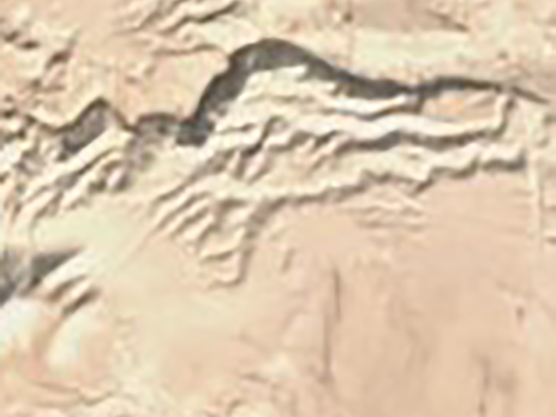
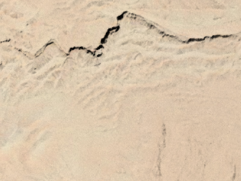
In previous posts, I talked about using a digital terrain model for high-resolution Bible maps and using AI to increase the resolution of satellite photos. In this post, I’ll talk about how you can use old black-and-white but high-resolution satellite photos to enhance lower-resolution modern satellite photos, converting this:
to this:
In 1995, President Clinton declassified images taken by Corona spy satellites from 1959 to 1972. These satellites operated at a resolution of up to six feet (around two meters) per pixel, a big improvement over the ten-meter imagery that the current free-and-highest-resolution Sentinel-2 program provides. However, the high-resolution Corona imagery is black-and-white, while the lower-resolution Sentinel imagery is in color. What if it were possible to combine the two?
Not only is it possible–it’s a common practice called pansharpening that you often see (unknowingly) in satellite imagery. The Landsat 8 satellite, for example, takes color pictures at a thirty-meter resolution and black-and-white pictures at a 15-meter resolution; when you combine them, you get a fifteen-meter output.
So if you take the ten-meter Sentinel imagery and pansharpen it with two-meter Corona imagery, you get something like the above image. I combined these images by hand using GDAL Pansharpen; merging them at scale is a more-complicated problem. But others have worked on it: the Corona Atlas and Referencing System run by the Center for Advanced Spatial Technologies (CAST) at the University of Arkansas actually uses Corona imagery to assist in Middle East archaeology. They run an atlas that lets you explore the high-resolution imagery as though it were Google Maps. The imagery’s age is actually an asset for this purpose; urban and agricultural development throughout the Middle East in the last fifty years obscures some archaeological sites in modern satellite imagery. CAST has georeferenced many Corona images and makes the data available for noncommercial use. The GAIA lab at UCSD also makes georeferenced imagery available as part of their Digital Archaeological Atlas of the Holy Land.