Since 2015, three major hillshading advances have allowed for more attractive but still accurate and efficient-to-create maps than before: advances in data, surfaces, and lighting.
(“Hillshading” means using shadow, light, and sometimes color to turn raw elevation data into something easily understandable by humans.)
Data advances: 30m digital elevation models
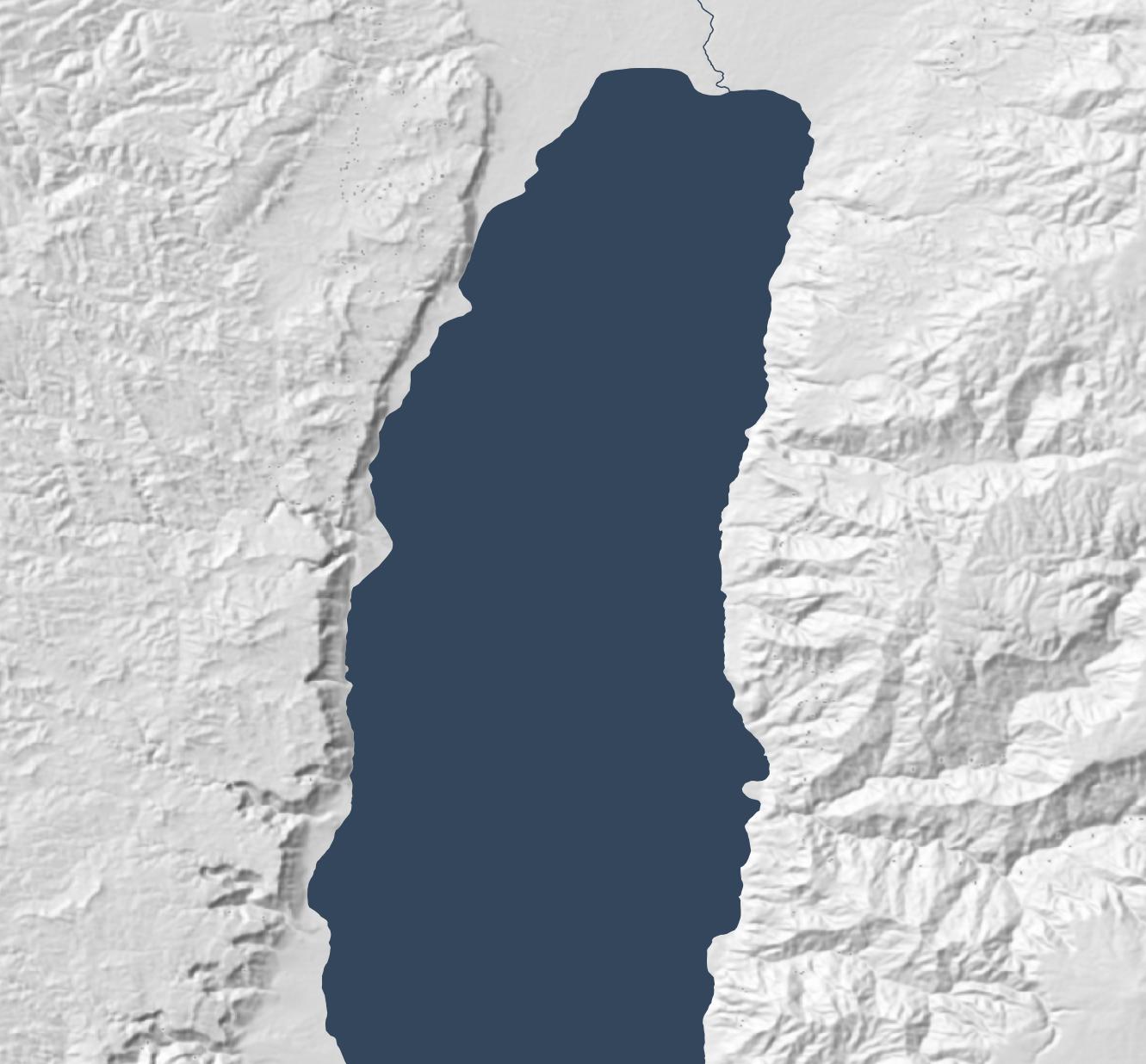
From 2003 through August 2015, 90m-per-pixel SRTM data was the best available resolution for the Middle East. Consequently, Bible atlases produced during this time have hillshading that looks something like the following, which is based on this data. (All the maps in this post show an area around the Dead Sea.)
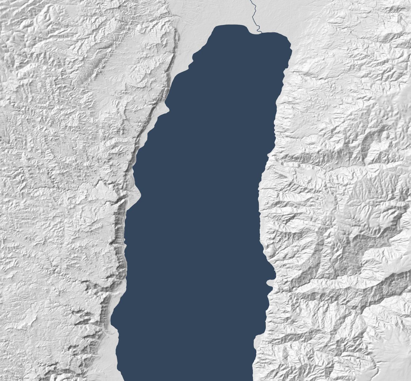
NASA released 30m-per-pixel elevation data in 2015, which means 9x more resolution is available. Everything feels crisper, though the extra detail makes the larger structures harder to discern:
Surface advances: Eduard
The above hillshading style, called “Lambertian,” derives from the 1700s. It’s computationally inexpensive (an algorithm describes it in 1981, and it can run on 1992-era computer hardware) and produces a decent result. This algorithm remains popular today; the standard ArcGIS hillshade function takes essentially the same approach.
Lambertian hillshading appeals to a modern desire for precision and accuracy when compared to older, manual hillshading methods. Since an algorithm is producing the hillshade, the viewer should be able to have confidence that they’re seeing a true depiction of the world. 1992’s Hammond Atlas of the World was the “first all-digital world atlas;” its introduction mentions “producing maps more accurately and more efficiently than ever before.”
In an AI era, however, we no longer have the luxury of believing that an algorithm neutrally presents reality. Algorithms shape us as much as we shape them. Lambertian hillshading presents a view of reality, but it’s not necessarily more “accurate” than manual hillshading; its purpose is to approximate pixel-level lighting, which is reflecting a computationally efficient point of view on what’s important to depict.
More practically, the main problem with Lambertian hillshading is that it “looks sort of like wrinkled tinfoil; full of sharp edges.” It’s busy, creating lots of detail while obscuring larger- and smaller-scale structures. So it’s accurate, but it doesn’t communicate well. By contrast, manual hillshading didn’t necessarily prioritize accuracy but emphasized helping the viewer understand the terrain’s structure. There are ways to make Lambertian hillshading read better (such as resolution bumping), but we now have better algorithms available.
Specifically, we have algorithms that mimic manual hillshading. Eduard (which I’ve mentioned previously) came out in 2022 and is specifically designed to recreate the look of twentieth-century Swiss cartographers, who “were widely regarded as preeminent in the development of printed maps that demonstrated a more naturalistic approach to relief portrayal.”
Eduard models surfaces better by addressing the question, “What form should the viewer see?” Rather than just modeling light (as Lambertian hillshading does), it employs multi-scale smoothing (suppressing noise compared to Lambertian’s pixel independence), a ridge/valley emphasis, and appropriate generalization to emphasize structure.
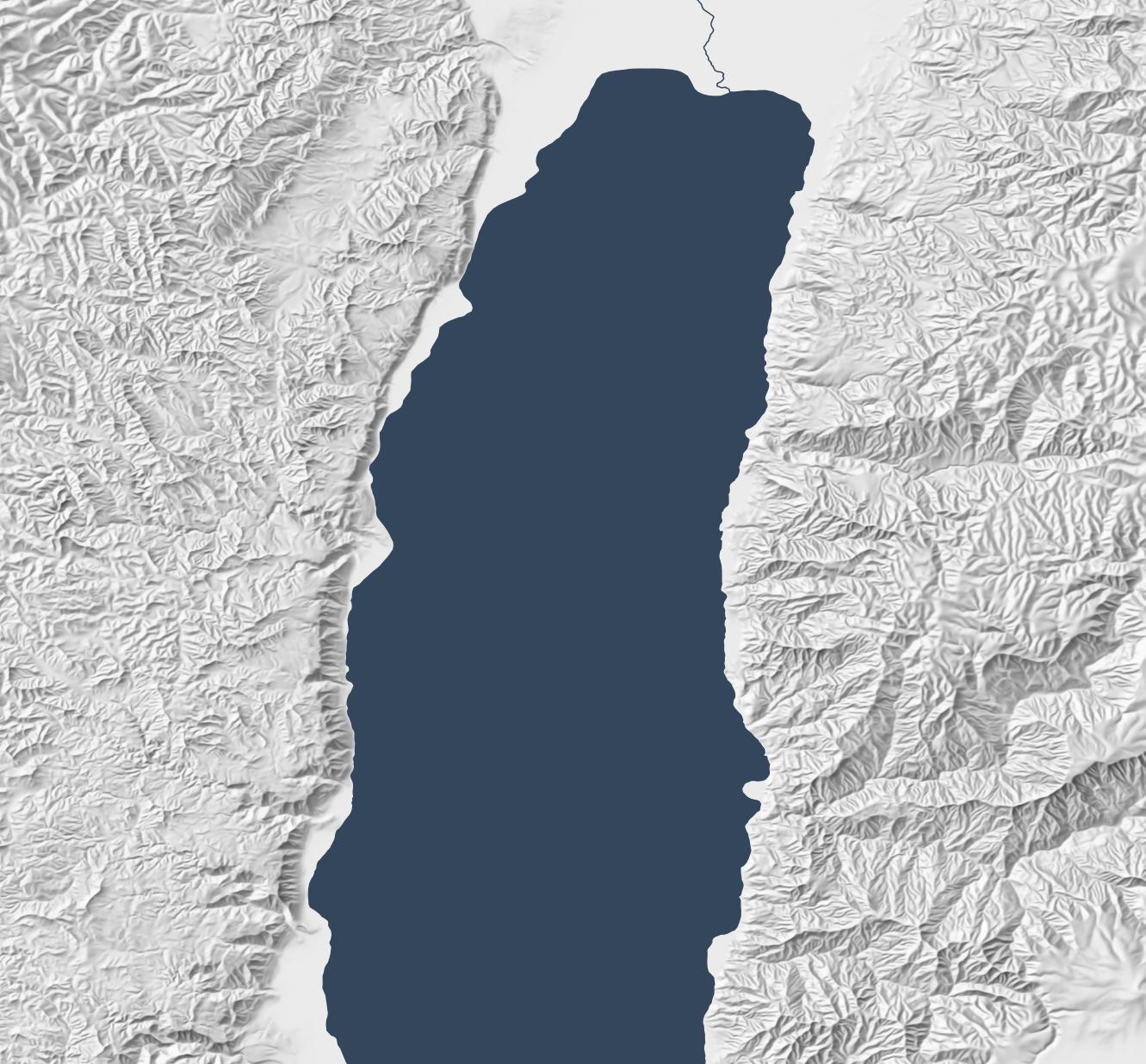
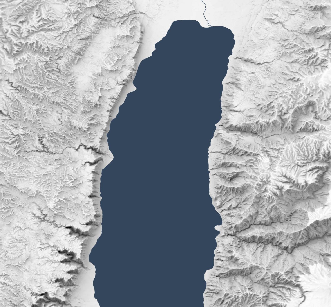
The below map, created with Eduard, uses the same 30m source DEM as the previous map but makes overall geomorphology clearer; small structures coalesce into larger ones, and ridges and valleys are clearer.
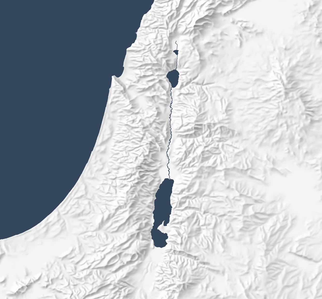
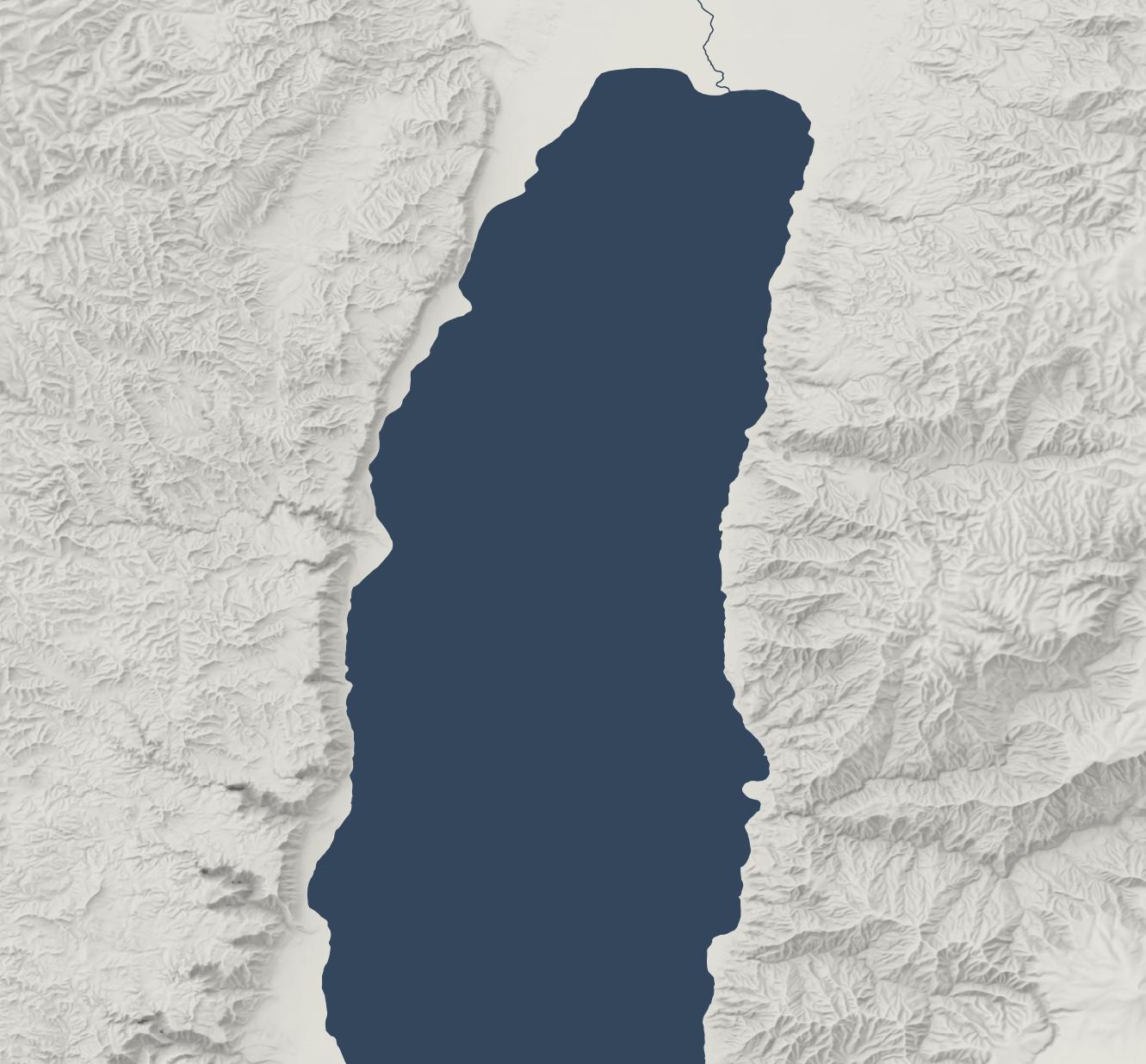
Eduard also generalizes well. The below map makes the overall structure of the Old Testament’s “Promised Land” clear, with coastal plains on the west moving into foothills, then into a central, hilly spine that gives way quickly to a rift valley with the Jordan River. This map preserves the large structures that allow the viewer to focus on the big picture.
Lighting advances: sky models
The final advance since 2015 involves the physics of rendering lighting. Daniel Huffman blogged about using Blender for shaded relief in 2013 and popularized it in a 2017 tutorial. This technique involves using 3D modeling software to produce more-realistic shadows than Lambertian shading does.
(ArcGIS introduced multidirectional hillshades in 2014, which is a refinement to the standard Lambertian approach but still creates an unnatural plastic effect to my eye. They also introduced several more hillshading tools in 2015.)
The below map uses the Sky Model in Terrain Shader Toolbox plugin for QGIS to produce a Blender-like effect using just shadows. (Check out this video for more background on this plugin.) The Sky Model creates 200 lighting snapshots from different angles and then combines them to produce a strong and dramatic shadowing effect. The Arnon gorge in the bottom right is clearly visible, as is the El Buqeia valley near the northwestern coast of the Dead Sea. It also captures the drama of gorges along the western coast of the Dead Sea.
Combining Approaches
The sky-model (or skybox) approach does have drawbacks; it compellingly preserves local features but doesn’t generalize them well. The best overall approach, in my opinion, is to combine 30m Eduard shading with the sky model, reducing their opacity so that they don’t overwhelm the landscape. This approach combines the generalizing features from Eduard with the detailed shadows from the sky model to produce an accurate, easy-to-understand hillshade:
Conclusion
Recent advances in data, surfaces, and lighting make hillshading from even ten years ago feel low resolution and computationally sterile. HIllshading from 1990 to 2020 fits into a historical era when “accuracy” and “efficiency” came to the forefront. It was based on the best data and techniques at the time, but new techniques allow us to move beyond Lambertian hillshading.
I expect that future Bible cartography will use these advances to produce attractive and understandable relief maps where the terrain depiction supports the map’s purpose, contributing to the map’s story without being distracting.