As previously hinted, the Jerusalem maps KML file (preview) now has three more overlays:

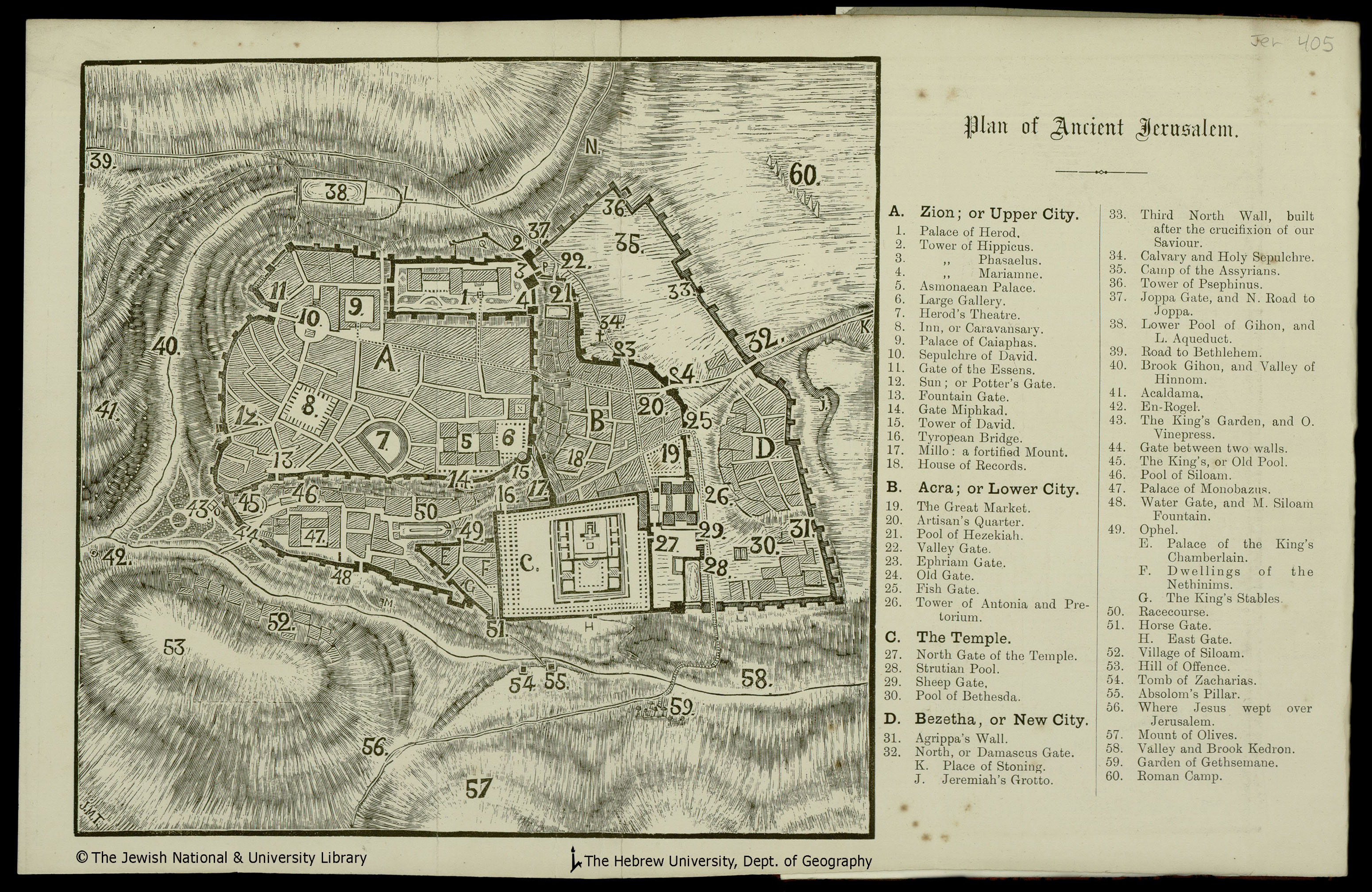
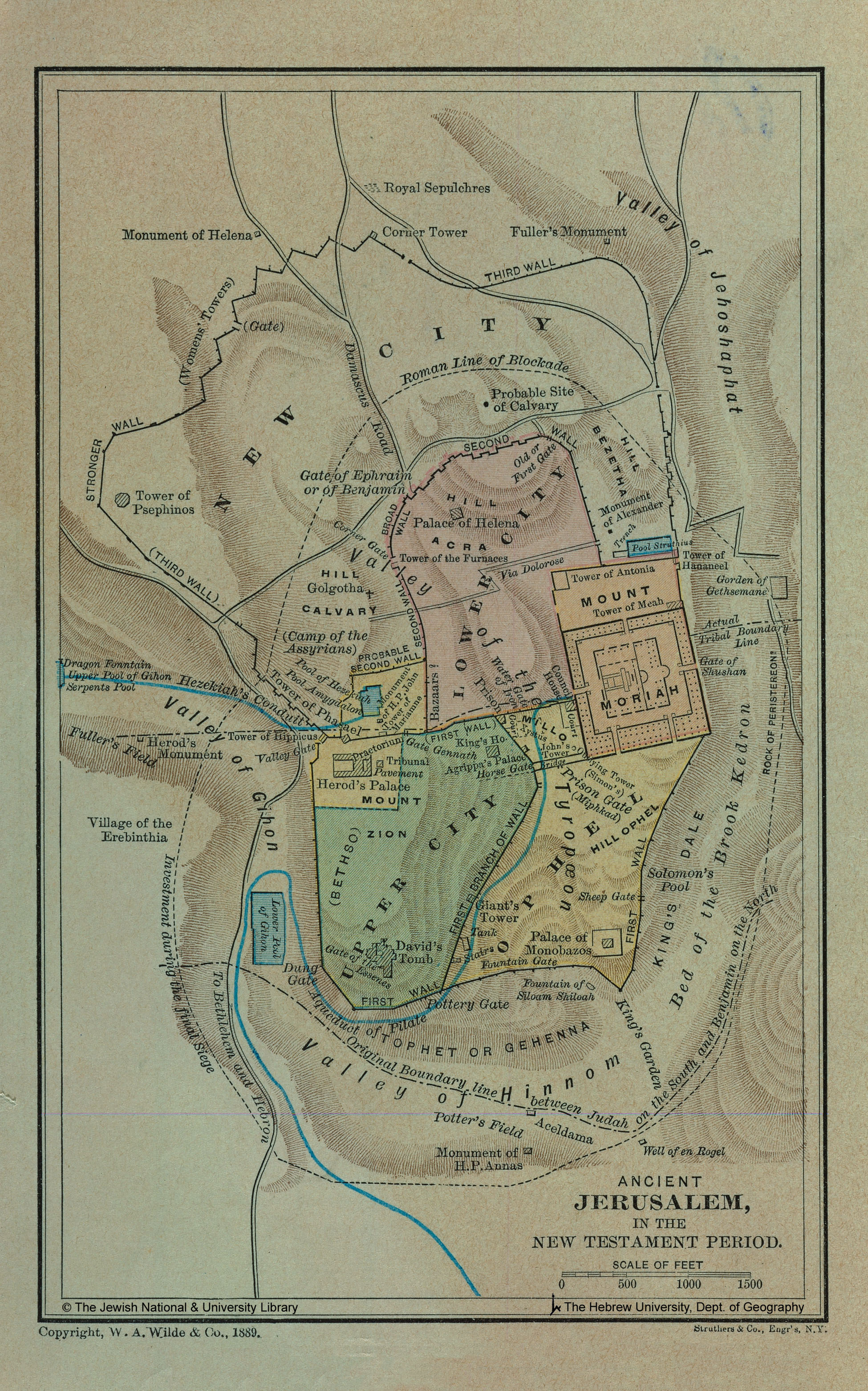
Thanks to The Jewish National & University Library, Shapell Family Digitization Project, Eran Laor Cartographic Collection and The Hebrew University of Jerusalem, Dept. of Geography, Historic Cities Project, for permission to use these images. Their website is full of historical maps of Jerusalem if you want to explore more of Jerusalem or create your own overlays.
[…] Open Bible propone altre mappe antiche integrate con la mappe di Google. Questa volta è possibile visualizzare in anteprima il risultato a questo indirizzo. Sicuramente è ottimale scaricare il file kml per un uso più efficente dei livelli. In Google Earth infatti è possibile selezionare per ogni livello una trasparenza in modo da poter vedere la città così come è oggi per metterla a confronto con le mappe antiche che sono in sovraimpressione. […]