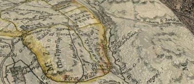
Download a KML for Google Earth containing map overlays for Jerusalem, both ancient and modern.
Don’t forget to adjust the transparency of the maps and turn on the Google Earth terrain layer to get a strong sense of the topography.
Twelve maps are there now—six of ancient Jerusalem and six of modern Jerusalem. They’re of varying accuracy, especially the ones of ancient Jerusalem.
All the maps come from the David Rumsey Historical Map Collection, an amazing website with thousands of maps, all available under a Creative Commons license, though a slightly different flavor from the one on the rest of this site. Please observe the licensing restrictions for the map images.
More overlays may be on the way from other sources depending on whether I can get permission from the copyright holders to use them. I have to say that I’m a big fan of Creative Commons.
I first heard about David Rumsey from O’Reilly Radar.

[…] previously hinted, the Jerusalem maps KML file (preview) now has three more […]