Bible Atlas
All the places in the Bible arranged alphabetically. Click the photos for more context.
All ‣ A ‣ B ‣ C ‣ D ‣ E ‣ F ‣ G ‣ H ‣ I ‣ J ‣ K ‣ L ‣ M ‣ N ‣ O ‣ P ‣ R ‣ S ‣ T ‣ U ‣ V ‣ W ‣ Y ‣ Z
Sahar
 Possible identifications: Sahl as Sahra, not a place (part of a phrase meaning "white wool")
Ezek 27:18
Salamis
 Possible identifications: Salamis
Acts 13:5
Salecah
 Possible identifications: Salkhad
Deut 3:10, Josh 12:5, 13:11, 1Chr 5:11
Salem
 Possible identifications: another name for Jerusalem
Gen 14:18, Ps 76:2, Heb 7:1, 7:2
Salim
 Possible identifications: Tel Shalem, Salim, Tell Abu Sus, Umm el Umdan, Wadi Saleim, within 5 km of Aenon
John 3:23
Salmone
 Possible identifications: Cape Sideros
Acts 27:7
Salt Sea
 Possible identifications: Dead Sea
Gen 14:3, Num 34:3, 34:12, Deut 3:17, 4:49, Josh 3:16, 12:3, 15:2, 15:5, 18:19, 2Kgs 14:25, 2Chr 20:2, Isa 16:8, Jer 48:32, Ezek 39:11, 47:8, 47:9, 47:10, 47:18, Joel 2:20, Zech 14:8
Samaria 1
 Possible identifications: Samaria
1Kgs 13:32, 16:24, 16:28, 16:29, 16:32, 18:2, 20:1, 20:10, 20:17, 20:34, 20:43, 21:1, 21:18, 22:10, 22:37, 22:38, 22:51, 2Kgs 1:2, 1:3, 2:25, 3:1, 3:6, 5:3, 6:19, 6:20, 6:24, 6:25, 7:1, 7:16, 7:18, 10:1, 10:6, 10:12, 10:17, 10:35, 10:36, 13:1, 13:6, 13:9, 13:10, 13:13, 14:14, 14:16, 14:23, 14:29, 15:8, 15:13, 15:14, 15:17, 15:23, 15:25, 15:27, 17:1, 17:5, 17:6, 17:24, 17:26, 17:27, 17:28, 17:29, 18:9, 18:10, 18:34, 21:13, 23:18, 23:19, 2Chr 18:2, 18:9, 22:9, 25:13, 25:24, 28:8, 28:9, 28:15, Ezra 4:10, 4:17, Neh 4:2, Isa 7:9, 8:4, 9:9, 10:9, 10:10, 10:11, 28:1, 28:3, 36:19, Jer 23:13, 31:5, 41:5, Ezek 16:46, 16:51, 16:53, 16:55, 16:61, 23:4, 23:33, Hos 7:1, 8:5, 8:6, 10:5, 10:7, 13:16, Amos 3:9, 3:12, 4:1, 6:1, 6:8, 8:14, Obad 19, Mic 1:1, 1:5, 1:6, 1:9
Samaria 2
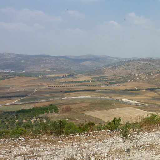 Possible identifications: Samaria 2
Luke 17:11, John 4:4, 4:5, 4:7, 4:9, Acts 1:8, 8:1, 8:5, 8:9, 8:14, 8:25, 9:31, 15:3
Samos
 Possible identifications: Samos
Acts 20:15
Samothrace
 Possible identifications: Samothraki
Acts 16:11
Sansannah
 Possible identifications: Khirbet esh Shamsaniyat, another name for Hazar-susah
Josh 15:31
Sardis
 Possible identifications: Sardis
Rev 1:11, 3:1, 3:4
Sarid
 Possible identifications: Tel Shadud
Josh 19:10, 19:12
Sea of Egypt
 Possible identifications: another name for the Red Sea 1, Gulf of Suez
Isa 11:15
Sea of Galilee
 Possible identifications: Sea of Galilee
Num 34:11, Josh 12:3, 13:27, Matt 4:18, 9:1, 15:29, Mark 1:16, 7:31, John 6:1, 21:1
Sea of Jazer
 Possible identifications: another name for Jazer, within 30 km of Jazer
Jer 48:32
Secacah
 Possible identifications: Khirbet es Samrah, Qumran, Ain Feshkah
Josh 15:61
Second Quarter
 Possible identifications: in Jerusalem
2Kgs 22:14, 2Chr 34:22, Neh 11:9, Zeph 1:10
Secu
 Possible identifications: between Gibeah and Ramah
1Sam 19:22
Seirah
 Possible identifications: in the hills of Ephraim, not a proper name (wooded area), in the Jordan Valley, in Moab 1
Judg 3:26, 3:27
Sela 1
 Possible identifications: another name for Sela 2, within 30 km of Akrabbim
Judg 1:36, 2Chr 25:12
Sela 2
 Possible identifications: Sela, Umm el Bayyara
2Kgs 14:7, Isa 42:11
Sela 3
 Possible identifications: Sela, Umm el Bayyara, another name for Sela 1, another name for Sela 2
Isa 16:1
Seleucia
 Possible identifications: Seleucia Pieria
Acts 13:4
Senaah
 Possible identifications: not a place (people group), another name for Magdalsenna, Khirbet el Aujah el Foqa
Ezra 2:35, Neh 3:3, 7:38
Seneh
 Possible identifications: Seneh
1Sam 14:4
Senir
 Possible identifications: another name for Mount Hermon
Deut 3:9, 1Chr 5:23, Song 4:8, Ezek 27:5
Sephar
 Possible identifications: Zafar, Al Baleed
Gen 10:30
Sepharad
 Possible identifications: another name for Sardis, another name for Saparda, another name for Sparta, in Media, in Spain, within 15 km of the Bosporus
Obad 20
Sepharvaim
 Possible identifications: another name for Sibraim, Sippar, another name for Saparre
2Kgs 17:24, 17:31, 18:34, 19:13, Isa 36:19, 37:13
Serpent’s Stone
 Possible identifications: within 100 m of En-rogel
1Kgs 1:9
Shaalbim
 Possible identifications: Salbit, Khirbet Salhab
Josh 19:42, Judg 1:35, 1Kgs 4:9
Shaalbon
 Possible identifications: another name for Shaalbim
2Sam 23:32, 1Chr 11:33
Shaalim
 Possible identifications: another name for Shual, about 10 km around Shaalbim
1Sam 9:4
Shaaraim 1
 Possible identifications: Khirbet es Sira, another name for Shaaraim 2, Khirbet Qeiyafa
Josh 15:36, 1Sam 17:52
Shaaraim 2
 Possible identifications: another name for Sharuhen
1Chr 4:31
Shahazumah
 Possible identifications: El Karm, Sheikh Mazghith, Tell Rekhesh, Sheikh esh Shamsawi, Hadita
Josh 19:22
Shalishah
 Possible identifications: about 15 km around Baal-shalishah
1Sam 9:4
Shallecheth
 Possible identifications: in Jerusalem, another name for the Gate of the Foundation, another name for Sur, another name for the Middle Gate
1Chr 26:16
Shamir 1
 Possible identifications: Khirbet Sumara, Khirbet Anab es Seghireh, Khirbet al Bira, Khirbet al Simia, Khirbet Anab al Kabir, Khirbet Fuqeiqis, Khirbet Raddana
Josh 15:48
Shamir 2
 Possible identifications: another name for Samaria 1, Khirbet Samara, another name for Shamir 1
Judg 10:1, 10:2
Shaphir
 Possible identifications: Tell as Sawafir, Khirbet el Qom, Tell Eton, not a place (poetic), another name for Shamir 1
Mic 1:11
Sharon 1
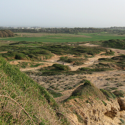 Possible identifications: Sharon Plain
1Chr 27:29, Song 2:1, Isa 33:9, 35:2, 65:10, Acts 9:35
Sharon 2
 Possible identifications: in the Transjordan, Madaba Plateau, within 30 km of Mount Hermon
1Chr 5:16
Sharuhen
 Possible identifications: Tall al Ajjul, Tel Sharuhen, Tel Haror, Tel Halif
Josh 19:6
Shaveh-kiriathaim
 Possible identifications: within 1 km of Kiriathaim 1
Gen 14:5
Sheba 1
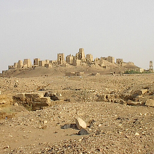 Possible identifications: Sheba
1Kgs 10:1, 10:4, 10:10, 10:13, 2Chr 9:1, 9:3, 9:9, 9:12, Job 6:19, Ps 72:10, 72:15, Isa 43:3, 60:6, Jer 6:20, Ezek 27:22, 27:23, 38:13, Joel 3:8
Sheba 2
 Possible identifications: another name for Beersheba 1, another name for Shema, Tel Beer Sheva
Josh 19:2
Shebarim
 Possible identifications: western cliff of Wadi Makkuk, within 2 km of Ai 1, not a proper name (quarries or similar), not a place (action taken by people)
Josh 7:5
Shechem
 Possible identifications: Tell Balatah
Gen 12:6, 33:18, 35:4, 37:12, 37:13, 37:14, Josh 17:7, 20:7, 21:21, 24:1, 24:25, 24:32, Judg 8:31, 9:1, 9:2, 9:3, 9:6, 9:7, 9:18, 9:20, 9:23, 9:24, 9:25, 9:26, 9:27, 9:28, 9:31, 9:34, 9:39, 9:40, 9:41, 9:42, 9:44, 9:57, 21:19, 1Kgs 12:1, 12:25, 1Chr 6:67, 7:28, 2Chr 10:1, Ps 60:6, 108:7, Jer 41:5, Hos 6:9, Acts 7:16
Sheep Gate
 Possible identifications: in Jerusalem
Neh 3:1, 3:32, 12:39, John 5:2
Shema
 Possible identifications: another name for Sheba 2, Tel Beer Sheva, another name for Jeshua, Tel Yeshua, Horbat Beer Shama
Josh 15:26
Shen
 Possible identifications: another name for Jeshanah, not a proper name (prominent hill or rock)
1Sam 7:12
Shepham
 Possible identifications: within 100 km of Riblah 2
Num 34:10, 34:11, 1Chr 27:27
Shephelah
 Possible identifications: Shephelah
Deut 1:7, Josh 9:1, 10:40, 11:2, 11:16, 12:8, 15:33, Judg 1:9, 1Kgs 10:27, 1Chr 27:28, 2Chr 1:15, 9:27, 26:10, 28:18, Jer 17:26, 32:44, 33:13, Obad 19, Zech 7:7
Sheshach
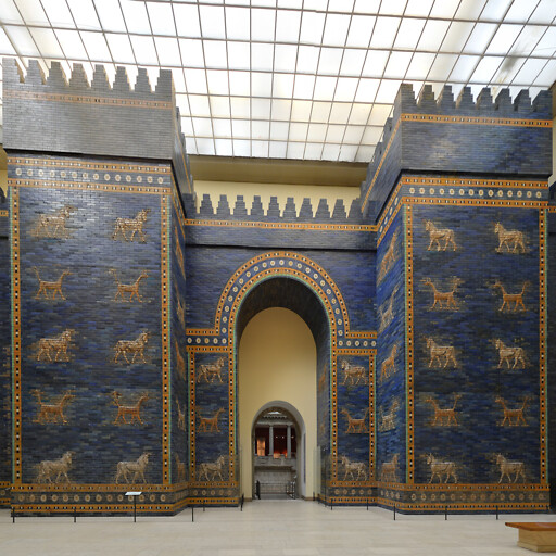 Possible identifications: another name for Babylon 1
Jer 25:26, 51:41
Shihor 1
 Possible identifications: Pelusiac branch of the Nile, Wadi al Arish, another name for the Brook of Egypt, another name for the Nile, not a proper name (may be a general reference to waters near the Nile)
Josh 13:3, 1Chr 13:5
Shihor 2
 Possible identifications: another name for the Shihor 1, another name for the Nile
Isa 23:3
Shihor-libnath
 Possible identifications: mouth of the Kishon River, Tell Abu Hawam, Kebara Swamps, Nahal Daliyya, Nahal Taninim
Josh 19:26
Shikkeron
 Possible identifications: Tell el Ful, Qatra, Aseret
Josh 15:11
Shilhim
 Possible identifications: another name for Sharuhen, another name for Shaaraim 2
Josh 15:32
Shiloah
 Possible identifications: another name for Siloam
Isa 8:6
Shiloh
 Possible identifications: Khirbet Seilun
Gen 49:10, Josh 18:1, 18:8, 18:9, 18:10, 19:51, 21:2, 22:9, 22:12, Judg 18:31, 21:12, 21:19, 21:21, 1Sam 1:3, 1:9, 1:24, 2:14, 3:21, 4:3, 4:4, 4:12, 4:13, 14:3, 1Kgs 2:27, 11:29, 12:15, 14:2, 14:4, 15:29, 2Chr 9:29, 10:15, Ps 78:60, Jer 7:12, 7:14, 26:6, 26:9, 41:5
Shimron
 Possible identifications: Tel Shimron, Maroun al Ras
Josh 11:1, 19:15
Shimron-meron
 Possible identifications: another name for Shimron
Josh 12:20
Shinar
 Possible identifications: another name for Babylonia
Gen 10:10, 11:2, 14:1, 14:9, Josh 7:21, Isa 11:11, Dan 1:2, Zech 5:11
Shion
 Possible identifications: Sirin, Ayun esh Sha’in, Khirbet Mugheir
Josh 19:19
Shittim
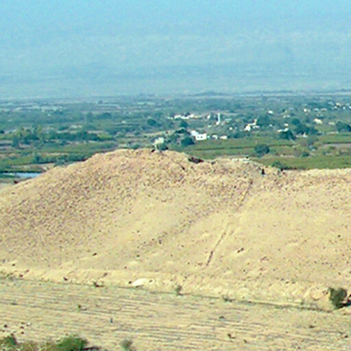 Possible identifications: Tall el Hammam, Tall Kafrayn, Tell Matabi
Num 25:1, Josh 2:1, 3:1, Hos 5:2, Mic 6:5
Shoa
 Possible identifications: another name for Sutu
Ezek 23:23
Shual
 Possible identifications: within 10 km of Ophrah 1, about 10 km around Rammun
1Sam 13:17
Shunem
 Possible identifications: Sulam
Josh 19:18, 1Sam 28:4, 1Kgs 1:3, 2:17, 2:21, 2Kgs 4:8, 4:11, 4:12, 4:25
Shur
 Possible identifications: region around Ar Ruwaysat, about 30 km around Wadi as Sakriyat, Tel Sharuhen
Gen 16:7, 20:1, 25:18, Exod 15:22, 1Sam 15:7, 27:8
Sibmah
 Possible identifications: Qarn al Qubish, Khirbet Ayun Musa, within 5 km of Baal-meon, Sumia
Num 32:3, 32:38, Josh 13:19, Isa 16:8, 16:9, Jer 48:32
Sibraim
 Possible identifications: in the region between Damascus and Hamath, Huwwarin, another name for Ziphron, another name for Sepharvaim
Ezek 47:16
Sidon
 Possible identifications: Sandikli archaeological site in Sidon
Gen 10:19, 49:13, Josh 11:8, 13:4, 19:28, Judg 1:31, 10:6, 18:7, 18:28, 2Sam 24:6, 1Kgs 11:1, 17:9, 1Chr 22:4, Ezra 3:7, Isa 23:2, 23:4, 23:12, Jer 25:22, 27:3, 47:4, Ezek 27:8, 28:21, 28:22, Joel 3:4, Zech 9:2, Matt 11:21, 11:22, 15:21, Mark 3:8, 7:24, 7:31, Luke 4:26, 6:17, 10:13, 10:14, Acts 12:20, 27:3
Silla
 Possible identifications: another name for the Millo
2Kgs 12:20
Siloam
 Possible identifications: Pool of Siloam
Neh 2:14, 3:15, Luke 13:4, John 9:7, 9:11
Sin
 Possible identifications: Debbet er Ramleh, El Marka, El Qaa
Exod 16:1, 17:1, Num 33:11, 33:12
Siphmoth
 Possible identifications: within 30 km of Eshtemoa
1Sam 30:28
Sirah
 Possible identifications: Ain Sarah, Serit el Bella
2Sam 3:26
Sitnah
 Possible identifications: within 15 km of Rehoboth 1, within 2 km of Sutnet er Ruheibeh, along Nahal Gerar, within 15 km of Gerar, in the region between Gerar and Beersheba
Gen 26:21
Smyrna
 Possible identifications: Izmir
Rev 1:11, 2:8
Socoh 1
 Possible identifications: Tel Socho
Josh 15:35, 1Sam 17:1, 2Chr 11:7, 28:18
Socoh 2
 Possible identifications: Khirbet Shuweikah
Josh 15:48
Socoh 3
 Possible identifications: Khirbet Shuweikat er Ras
1Kgs 4:10
Sodom
 Possible identifications: in the Valley of Siddim, Bab edh Dhra, in the region north of the Dead Sea, Tall el Hammam, Numeira
Gen 10:19, 13:10, 13:12, 13:13, 14:2, 14:8, 14:10, 14:11, 14:12, 14:17, 14:21, 14:22, 18:16, 18:20, 18:22, 18:26, 19:1, 19:4, 19:24, 19:28, Deut 29:23, 32:32, Isa 1:9, 1:10, 3:9, 13:19, Jer 23:14, 49:18, 50:40, Lam 4:6, Ezek 16:46, 16:48, 16:49, 16:53, 16:55, 16:56, 16:61, Amos 4:11, Zeph 2:9, Matt 10:15, 11:23, 11:24, Mark 6:11, Luke 10:12, 17:29, Rom 9:29, 2Pet 2:6, 2:7, Jude 7, Rev 11:8
Solomon’s Portico
 Possible identifications: in Jerusalem
John 10:23, Acts 3:11, 5:12
South 1
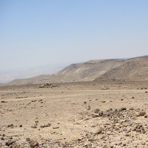 Possible identifications: another name for the Negeb
Zech 7:7
South 2
 Possible identifications: another name for Sheba 1
Matt 12:42, Luke 11:31
South 3
 Possible identifications: South 3
Dan 11:5, 11:6, 11:7, 11:9, 11:11, 11:12, 11:14, 11:15, 11:17, 11:25, 11:29, 11:40
South Gate
 Possible identifications: in Jerusalem
1Chr 26:15
Spain
 Possible identifications: Hispania
Rom 15:24, 15:28
Straight Street
 Possible identifications: Straight Street
Acts 9:11
Succoth 1
 Possible identifications: Tell Deir Alla, Tell el Ekhsas
Gen 33:17, Josh 13:27, Judg 8:5, 8:6, 8:8, 8:14, 8:15, 8:16, 1Kgs 7:46, 2Chr 4:17
Succoth 2
 Possible identifications: Tell el Maskhuta, within 2 km of Jabal Maryam, Tell er Retaba, another name for Pithom
Exod 12:37, 13:20, Num 33:5, 33:6
Suph
 Possible identifications: another name for the Red Sea 2, another name for Suphah, Sufeh
Deut 1:1
Suphah
 Possible identifications: Sufeh, another name for Suph, another name for the Red Sea 2
Num 21:14
Sur
 Possible identifications: another name for the Gate of the Foundation
2Kgs 11:6
Susa
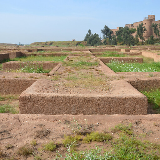 Possible identifications: Shush
Ezra 4:9, Neh 1:1, Esth 1:2, 1:5, 2:3, 2:5, 2:8, 3:15, 4:8, 4:16, 8:14, 8:15, 9:6, 9:11, 9:12, 9:13, 9:14, 9:15, 9:18, Dan 8:2
Sychar
 Possible identifications: Askar, another name for Shechem
John 4:5
Syene
 Possible identifications: Aswan
Isa 49:12, Ezek 29:10, 30:6
Syracuse
 Possible identifications: Syracuse
Acts 28:12
Syria 1
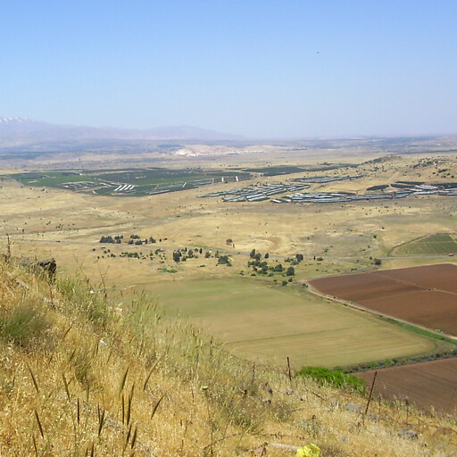 Possible identifications: Aram
Josh 1:4, Judg 10:6, 2Sam 8:5, 10:9, 10:11, 10:13, 10:14, 10:17, 10:18, 10:19, 1Kgs 10:29, 11:25, 15:18, 19:15, 20:1, 20:20, 20:21, 20:22, 20:23, 20:26, 20:28, 22:1, 22:3, 22:11, 22:31, 22:35, 2Kgs 5:1, 5:2, 5:5, 6:8, 6:9, 6:11, 6:23, 6:24, 7:5, 8:7, 8:9, 8:13, 8:28, 8:29, 9:14, 9:15, 12:17, 12:18, 13:3, 13:4, 13:5, 13:7, 13:17, 13:19, 13:22, 13:24, 15:37, 16:5, 16:6, 16:7, 24:2, 1Chr 18:5, 18:6, 19:10, 19:12, 19:14, 19:15, 19:16, 19:17, 19:18, 19:19, 2Chr 1:17, 16:2, 16:7, 18:10, 18:30, 18:34, 22:5, 22:6, 24:23, 24:24, 28:5, 28:23, Isa 7:1, 7:2, 7:4, 7:5, 7:8, 9:12, 17:3, Ezek 16:57, 27:16, Amos 1:5
Syria 2
 Possible identifications: Syria 2
Matt 4:24, Luke 2:2, Acts 15:23, 15:41, 18:18, 20:3, 21:3, Gal 1:21
Syrtis
 Possible identifications: Sidra
Acts 27:17
Image Credits
Exmak, Maris Teteris, Tammam Narsh, Godot13, אור פ, C messier, Mujaddara, Ovedc, Mujaddara, Bob&Anne Powell, Angelos Konstantinidis, Contains modified Copernicus Sentinel data 2019, simonjenkins’ photos, Hanay, ديفيد عادل وهبة خليل 2, Bahnfrend, יעקב, Basheer.f, יעקב, Htkava, Almog, P. Yule, Frank Kidner, kfar hatemanim, Bukvoed, Hanay, עדירל, Topazbarziv, Ori~, Malkawi99, Tapatio, gugganij, Bukvoed, יאיר דב, יעקב, Rabih omeiri, Davidbena, Radomir Vrbovsky, Iri-en-achti, Zvi Roger, Tamar Hayardeni, RonAlmog, Hanay, Deg777, David Stanley, Ralf Lotys, NaVisitor, Einsamer Schütze, محمد الفلسطيني, 31774, Davidbena, Adeeb Atwan, ליאור גולגר, GT1976, Basotxerri, Bernard Gagnon, Matson Collection, mikkelsaar, Carole Raddato, Marc Ryckaert, fotovideomike, Dr. Avishai Teicher, عمرو بن كلثوم, المجبري