Google just updated their Static Maps API to include satellite imagery, and the atlas now uses this API to display thumbnail maps.
The atlas previously used pregenerated images that looked like this:

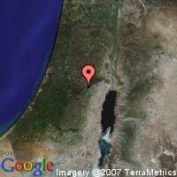
Now the image for Jerusalem looks like this:
The Google Static Maps API is a way to get all the nice imagery of Google Maps without incurring the interactive overhead. It’s useful in situations where, like an atlas, you just want to show a static image. Until yesterday, you could only get street maps in the Static Maps API.
This change benefits you—you always see up-to-date imagery—and it’s easier for me, since I don’t need to regenerate images if the locations change.